
The physical environment.
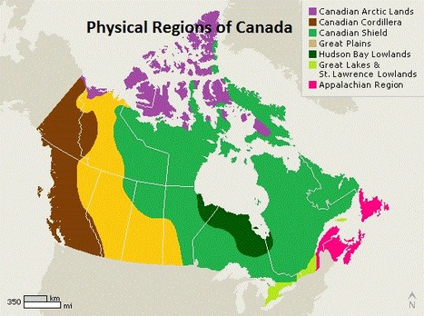
The physical environment of Canada is most definitely a factor which makes many believe that Canada is the best place to live. Although I strongly believe that there are some things Canada needs to work on in order to achieve the title, "best country in the world." I can agree that the Canadian landscape is near perfect in my opinion. I think this because the Canadian landscape offers many different kinds of resources in our regions which provides a variety of different job opportunities as well and the climate we have is excellent. Geological, climatic, hydro logical processes have shaped Canada into the landscape that it has today. These processes have given us the 7 regions that we know of today. The seven physical regions of Canada are the interior plains, the Canadian shield, the Appalachian region, the Hudson bay lowlands, arctic lands, The Canadian Cordillera and finally the great lakes & st. Lawrence lowlands. These regions offer a variety of different resources for Canada. there are many countries that only export few or possibly one type of resource while Canada on the hand, provides multiple different resources. This is good because a variety of resources provides a good amount of trade opportunities with other countries.
Canada's 7 regions
I personally believe that our regions are so great because they provide a variety of different resources. Being able to provide different types of natural resources as a country is great because there are a lot more trade opportunities we have rather than, a country which can only produce certain types of natural resources due to their climate, land form, e.t.c. Our land form regions provide resources such as forestry, fishery and agriculture. Canada is also the number 1 provider of oil to the USA. Canada's landscape is built in a ways that we can provide so many different natural resources for our own country as well as, natural resources which can be sold for trade as a contribution to the Canadian economy.
The Interior plains.

- The interior plains takes up around 19 percent of Canada's land.
- The temperatures vary between 10- 30 degrees in the summer and in the winter, temperatures can reach up to a - 30 degrees Celsius.
- hobbies in the interior plains include hiking and hockey due to how cold it can get, especially up north due to elevation.
- farmers typically like the interior plains because, it offers larges, flat plots of land with a great amount of sun and water supply for agriculture.
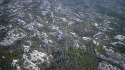
The Canadian shield

- The Canadian shield covers about half of Canada.
- The oldest part of the north american crustal plate.this land form region is raised above water level.
- The Canadian shield ranges between 305- 610 meters above sea level.
- The world's richest areas in terms of mineral ores.
- the Canadian shield is a land form region known for exporting gold and diamonds and other kinds of gems.
- not suitable for forestation.
The Appalachian region
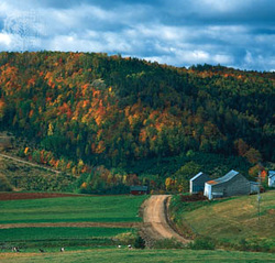
- extends from Newfoundland into the eastern United States.
- This region is rich in fishery.
- The Appalachian region is also rich in oil.
- salmon, Pollock, halibut, red fish, herring and lobster are harvested in the Canadian Appalachians.
- The Appalachian region has a very wet climate and it's summers can vary between being warm, or cold.
- The Appalachian region is very rich in forestry.
- This region extracts many plant species such as birch, beech, and red maple.
The Hudson bay lowlands
- The Hudson Bay Lowlands contains 20 percent of Ontario's forests.
- The Hudson bay lowlands provides a lot of Canada's forestry.
- White birch and willow are the common deciduous trees grown in this region.
- water and oil are other resources provided in this region.
- Cold, dry arctic air throughout winter in this area.
- The soil in the region contains lots of minerals (nutrients) which is great for the growth of trees.
- The average growing season ranges from 500 to 1 000 growing degree days above 5°C
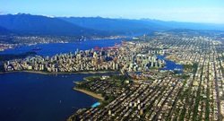
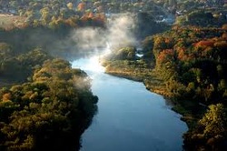
The great lakes & the st. lawrence lowlands
- This region contains a lot of moisture in the air.
- very humid winters and summers
- this climate is a reason why this land form region provides rich soil as one of their natural resources.
- This region has the best source of water in Canada because in this region there is the St. Lawrence River, Niagara Falls and the Great Lakes.
- some scientists believe that this region may have been part of the ocean floor at some point in time. They think this because the soil in this region is abnormally very fertile.
- This region is rich in minerals which are found in the rocks of this land form region.
The Canadian cordillea
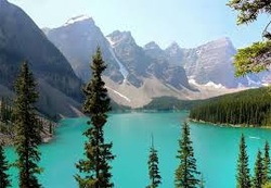
- The Cordillera is located on the west coast of Canada
- the Canadian cordillera has a very mild climate. this means that in this region, it rarely snows heavily because of the very moist air.
- Parts of this region are covered with forests.
- Moist air and soil.
- The moist air and soil make forestry the most popular resource of this region.
- This region contains a lot of mountains and hills and is not generally very flat.
The Canadian arctic lands
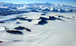
- The Canadian arctic region makes u 40% of our landmass.
- ice sheets that covered almost all of north america originated in the Canadian arctic region.
- located in the northernmost part of the North American continent.
- provinces such as the northwest territories, the Yukon and Nunavut are provinces which are considered a part of this land- form region.
- Animals resources such as fur are popular resources that come from this land form region because of the animals that live here.
- the arctic region provides a significant amount of, minerals, boreal forestry, marine life and a lot of fresh water.
Climate
Canada is located at water level which puts us at a less risk of natural disasters such as, monsoons and tornadoes. this is just one of the reason I find that Canada has one of the most amazing landscapes. Each of the following regions are known for providing specific resources. Another reason that I would consider Canada to have a great landscape is because, We are fortunate as a country to be able to experience a combination of both cold and warm seasons. Studies show that those who live in countries that are situated near the equator, are more prone diseases such as malaria, due to the extreme weather conditions. The sickness of the civilians can really hurt the economy because when people are sick, they loose the will to work or they are simply just to sick to work. This can really effect developing countries in which their job focus is based on primary industries like agriculture. for example if a farmer were too sick to work for 2 months due to his/ her illness, the amount of product he would be providing in that year would be minimal. In conclusion, Canada is not too close to the equator therefore we experience less negative impacts from the warmer weather compared to, countries which are indeed very close or even on the equator.
